Climatological summer runs from June 1 to August 31, and we just passed the midway mark of the season. So, through July 15, how has this summer been in Columbus and central Ohio?
Temperatures
Overall, this has been a warm summer in Columbus. June featured a seven-day streak with highs of at least 90° from the 16th to the 22nd. That was the longest such stretch since July 2020, and the longest in June since 1999.
Rainfall
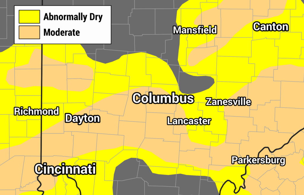
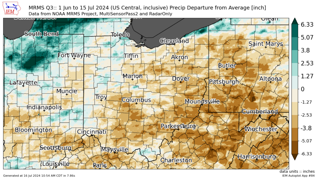
Dry weather has plagued the area this summer, enough that moderate drought conditions have developed.
No measurable rain fell from June 6–22, a 17-day streak.


Storm Reports
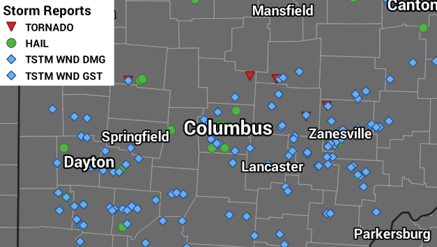
While this summer hasn’t been as active as spring when it comes to severe weather, four tornadoes have been confirmed. Four happened on June 5–6 north and east of Columbus, including three EF-0s and one EF-2. One more EF-0 occurred on July 3 well northwest of Columbus.
Various storm complexes also brought strong wind gusts, along with a handful of hail reports.

See an interactive map of storm reports here.
